 Fernbrook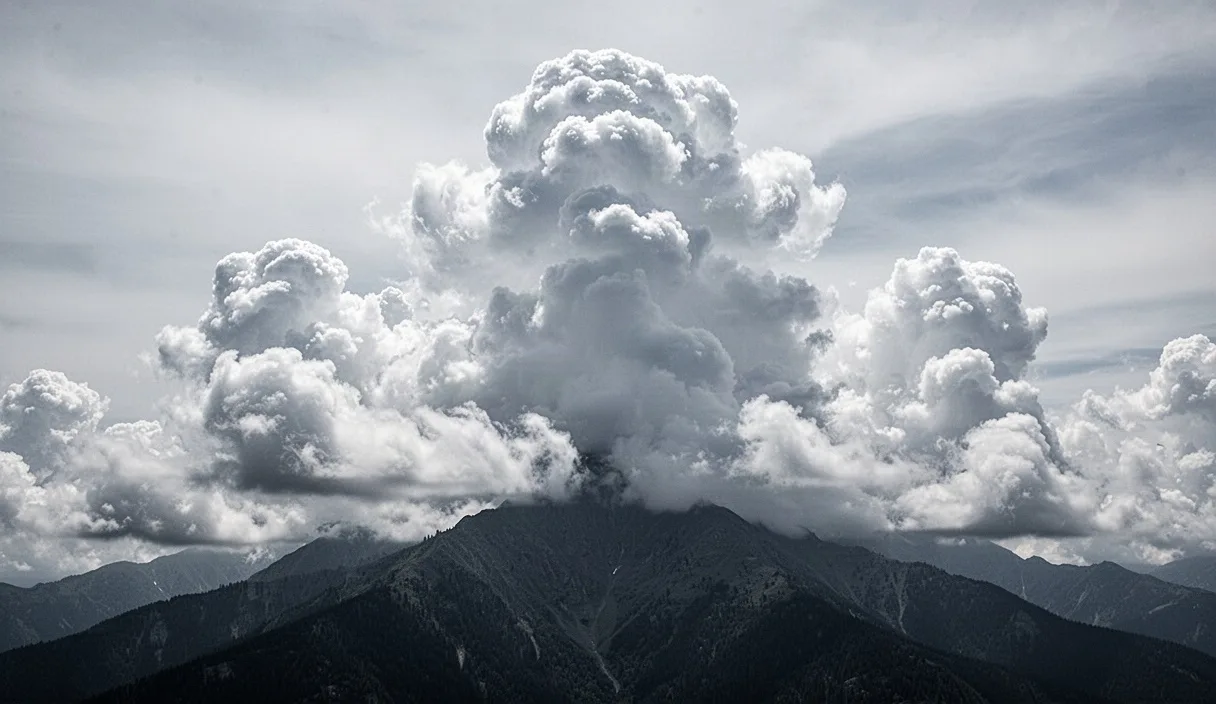

Afternoon thunderstorms rarely arrive without notice. Long before the first rumble of thunder or the first cold gust of outflow reaches you, the sky has usually been rehearsing its intentions for an hour or more, in the shape, height and behavior of the clouds overhead. Learning to read those signs is less about memorizing cloud names and more about tracking a sequence: how quickly clouds build, what happens at their tops, and how the wind around you changes as they mature.
This matters most to anyone spending unprotected hours outdoors, on a ridge, a lake, a golf course or an open trail, where the difference between reading the sky an hour early and reading it ten minutes late can be the difference between a calm walk back to shelter and a genuinely dangerous scramble. None of what follows replaces a weather forecast or a local warning system; it is a supplement to them, useful mainly in the gap between checking a forecast in the morning and finding yourself somewhere with no signal in the afternoon.
Cumulus Growth as an Early Warning Sign
The first clue is almost always cumulus cloud behavior earlier in the day. Fair-weather cumulus, the small, flat-bottomed, cotton-like clouds common on sunny mornings, are not a concern on their own. What matters is the rate at which they grow vertically as the day warms. If by mid-morning those clouds are still small and widely spaced, the atmosphere is likely stable enough for the day. If, by contrast, you notice cumulus clouds visibly taller at noon than they were at 10 a.m., with bases darkening and tops beginning to look more like cauliflower than cotton, that is a sign of strengthening convection.
A useful rough gauge is the ratio between a cloud's height and its width. Early cumulus tends to be wider than it is tall. As instability builds, that ratio flips, and clouds start to look taller than they are wide, a stage often called cumulus congestus. This transition frequently happens between 11 a.m. and 2 p.m. in continental climates during summer, though the exact timing depends heavily on surface heating and moisture.
A practical field method is to pick a single cloud and watch it for five to ten minutes without looking away. If its top visibly rises during that short window, rather than just drifting sideways, the atmosphere has enough energy to keep building that cloud into a storm later. Clouds that merely drift, without vertical growth, are far less concerning.
Some other early indicators worth tracking alongside cumulus growth:
- Increasing cloud cover before noon on a day that started clear, suggesting moisture is arriving faster than expected.
- A hazy or milky sky in the morning that clears suddenly, sometimes a sign of an approaching disturbance rather than genuine clearing.
- Cumulus clouds forming in lines rather than scattered randomly, which can indicate a convergence zone where storms are more likely to organize.
Anvil Clouds and What They Signal
Once a storm cloud has matured into a cumulonimbus, its top often flattens out into a broad, fibrous shelf resembling a blacksmith's anvil. This happens because the rising air inside the storm hits the tropopause, the boundary where the atmosphere stops cooling with height, and can rise no further, so it spreads horizontally instead. Seeing a distinct anvil is a reliable sign that a storm has reached, or is very near, full maturity.
The direction the anvil points matters as much as its presence. Because upper-level winds are usually stronger than surface winds, the anvil tends to stretch out in the direction the storm's outflow and heavy rain will eventually travel. If an anvil is spreading directly overhead or toward your position, that storm's effects, rain, lightning, and gusty wind, are likely to reach you even if the visible storm core still looks distant.
Anvils are also useful for distinguishing an isolated storm from a developing cluster. A single, well-defined anvil with clear sky around it usually belongs to one storm cell that may pass relatively quickly. A sky where several anvils have merged into one continuous high shelf suggests a multicell or squall-line situation, which tends to bring longer-lasting weather and a wider area of impact.
A few visual cues tied to anvils that are worth watching for:
- Mammatus clouds, pouch-like bulges hanging from the underside of an anvil, often appear after the most intense part of a storm has passed, though turbulence and gusty wind can still linger.
- Overshooting tops, small domes rising above the flat anvil surface, indicate an especially strong updraft and often precede severe wind or hail.
- A darkening, greenish tint under the anvil has been associated anecdotally with hail-bearing storms, though this is not a rule you should rely on for safety decisions.
Wind Shifts That Precede a Storm Front
Wind is often the most immediate and physically obvious warning sign, arriving after the visual cues but still ahead of the rain itself. As a storm's downdraft reaches the ground, it spreads outward as a gust front, which frequently arrives 10 to 20 minutes before the rain core, sometimes with a noticeable temperature drop of 5 to 10 degrees Fahrenheit within a minute or two.
Before that gust front, many people notice the opposite: a period of unusually still, warm, humid air, sometimes described as the atmosphere feeling "heavy." This lull can occur because the storm's inflow is drawing surface air toward its base, temporarily reducing the wind you feel at ground level even as the storm itself intensifies overhead.
A sudden shift in wind direction, particularly one that swings from a warm, southerly flow to a cooler, northerly or westerly one in North American mid-latitudes, is a strong sign that a front or outflow boundary has arrived. Leaves turning to show their undersides, dust or loose debris lifting off open ground, and flags snapping to a new direction are all visible confirmations of this shift, useful when you cannot feel the wind directly, for instance while inside a vehicle.
Comparing wind behavior at different storm stages can help with quick judgment calls in the field.
| Wind Behavior | Likely Storm Stage | Suggested Action |
|---|---|---|
| Calm, warm, slightly humid air | Inflow stage, storm still building | Continue monitoring the sky, note your nearest shelter |
| Sudden gusty wind, temperature drop | Gust front arriving, rain likely within 15-20 minutes | Begin moving toward shelter now |
| Wind direction reverses and stays steady | Frontal passage or main outflow underway | Take shelter immediately if not already there |
Timing: How Much Warning You Actually Get
The honest answer is that warning time varies considerably, and treating any single number as guaranteed is a mistake. In many mid-latitude summer setups, the visible transition from moderate cumulus congestus to a mature thunderstorm with a defined anvil takes somewhere between 45 minutes and 90 minutes, giving a reasonably attentive observer a useful head start.
Isolated, slow-moving storms in weak steering winds can sit and build for well over an hour before producing significant rain or lightning, giving generous warning to anyone watching the sky. Fast-moving squall lines or storms embedded in strong upper winds, by contrast, can close a visible distance of ten miles in twenty minutes, compressing the usable warning window to something closer to fifteen or twenty minutes once the storm becomes visually obvious.
Lightning is a separate and more urgent timing consideration, since it can strike from a storm cloud that is still several miles away, well before rain or strong wind arrives. A widely used field guideline is the count between seeing a flash and hearing thunder: roughly five seconds per mile of distance. A count of 30 seconds or less is commonly treated as a signal to seek sturdy shelter without delay, though this is a rule of thumb rather than a precise safety threshold, and local emergency guidance should always take precedence.
Regional Variables That Change the Pattern
Terrain and climate reshape all of the above patterns considerably. In mountainous regions, afternoon convection often initiates over peaks and ridgelines by late morning because slopes heat unevenly and faster than valley floors, meaning storm signs can appear earlier in the day, sometimes by 11 a.m., compared with flatter terrain where storms may not organize until mid-afternoon.
Coastal areas introduce a sea breeze effect, where cooler air moving inland from open water can trigger a line of storms along the boundary where it meets warmer land air, often visible as a distinct band of cumulus a few miles inland rather than directly over the coastline itself. This boundary can be a reliable, near-daily feature in summer in places like Florida, sometimes forming by early afternoon with clockwork regularity.
Arid and high-desert regions tend to produce dramatic-looking cumulonimbus clouds that nonetheless produce little surface rain, since precipitation can evaporate before reaching the ground, a phenomenon known as virga. In these areas, the storm's real hazards are often wind, dust, and lightning rather than rainfall, meaning a cloud that looks like it is "missing" its rain should not be read as harmless.
A short list of regional adjustments worth keeping in mind:
- In mountain terrain, start watching the sky by mid-morning rather than early afternoon.
- Near coastlines, watch for a distinct cloud line forming inland, not directly overhead at the shore.
- In dry climates, treat visible lightning and gusty wind as serious even if little rain appears to be falling.
- In humid, flat regions, expect the classic cumulus-to-cumulonimbus progression to follow a more textbook timeline.
Deciding When to Turn Back
Turning back is rarely a single dramatic decision; it is usually the sum of several smaller observations reaching a threshold. A reasonable approach is to treat any two of the following as sufficient reason to head toward shelter: visible vertical cloud growth accelerating within the last thirty minutes, a distinct anvil forming and pointing toward your position, or a noticeable shift in wind direction accompanied by a temperature drop.
Distance from shelter should factor directly into the decision, not as an afterthought once the storm is already close. If the nearest solid shelter, a building, vehicle, or substantial structure, is more than 20 to 30 minutes away on foot, the decision point should move earlier, ideally at the first sign of accelerating cloud growth rather than waiting for a mature anvil.
Groups traveling together, particularly with children, older adults, or anyone with mobility limitations, should build in extra margin, since actual travel speed under stress or fatigue is often slower than expected. It is worth designating one person specifically to watch the sky periodically rather than assuming everyone is monitoring conditions equally.
Common Mistakes
The most frequent error is waiting for rain or thunder before beginning to move, when both typically arrive well after the storm's hazards, particularly lightning and gust fronts, have already reached a given location. A second common mistake is fixating on a single distant storm cell while ignoring newer, closer development happening off to the side, since afternoon convection often produces multiple cells rather than one isolated storm. A third is assuming a clearing sky in one direction means safety, without checking the rest of the horizon, since storms frequently form on more than one side of a position simultaneously in unstable conditions.
Practical Next Steps
Before heading into exposed terrain on a warm, humid day, check a morning forecast specifically for convective outlooks or thunderstorm probability, not just a general precipitation percentage, and note the expected timing of peak instability. While outdoors, build a habit of glancing at the sky every twenty to thirty minutes rather than only when something feels obviously wrong, and identify your nearest shelter option before you think you will need it. If lightning becomes audible or the wind shifts abruptly, treat that as the moment to act rather than the moment to start deciding, and consult local weather services or emergency management guidance for area-specific safety thresholds, since terrain, climate and storm behavior vary enough that no single article can substitute for local expertise.